

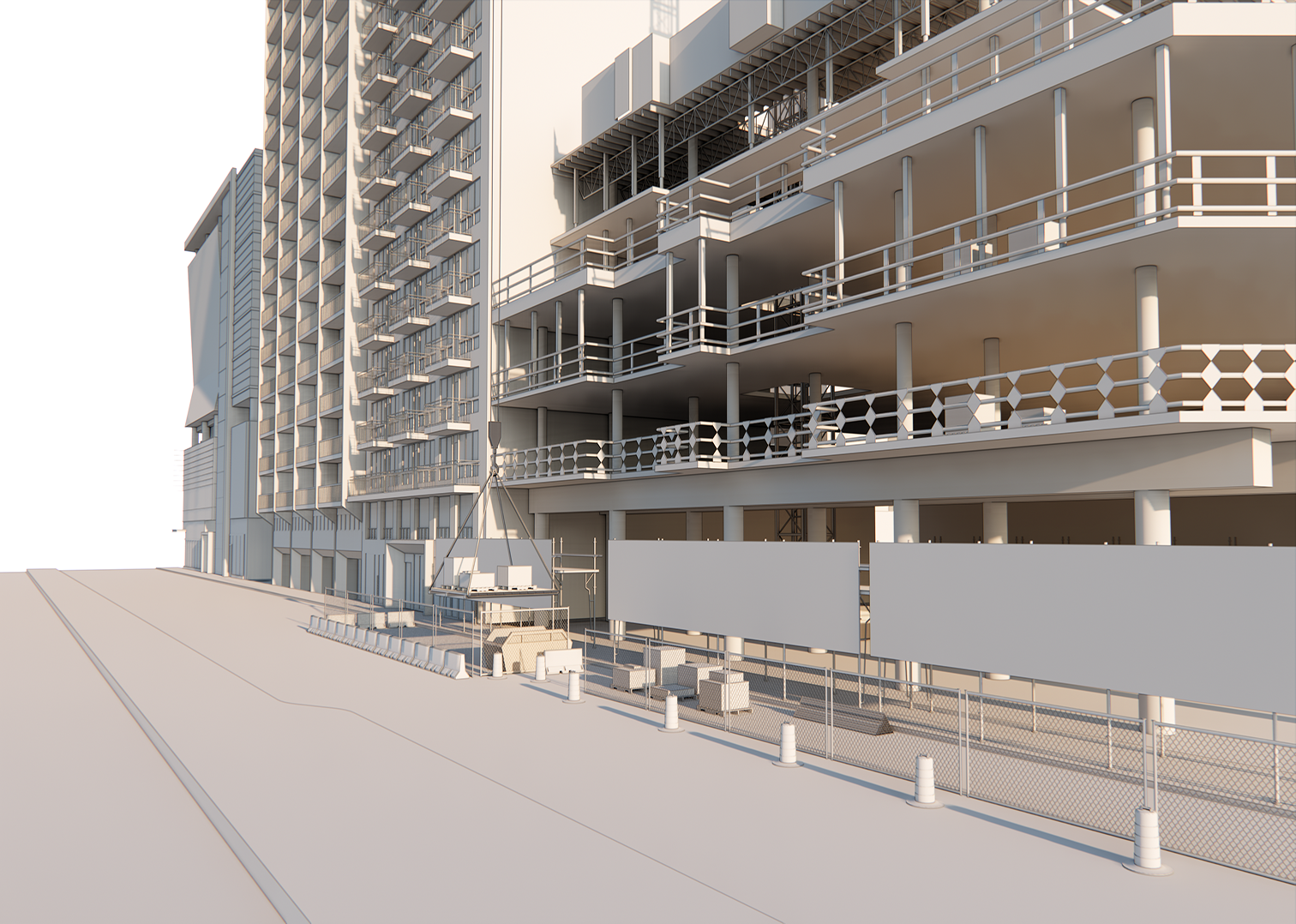
Portfolio
A curated selection of academic research, professional projects, software tools, and freelance work spanning visualization, urban modeling, automation scripting, and GIS workflows.
Professional Projects
(Modeling & Visualization)
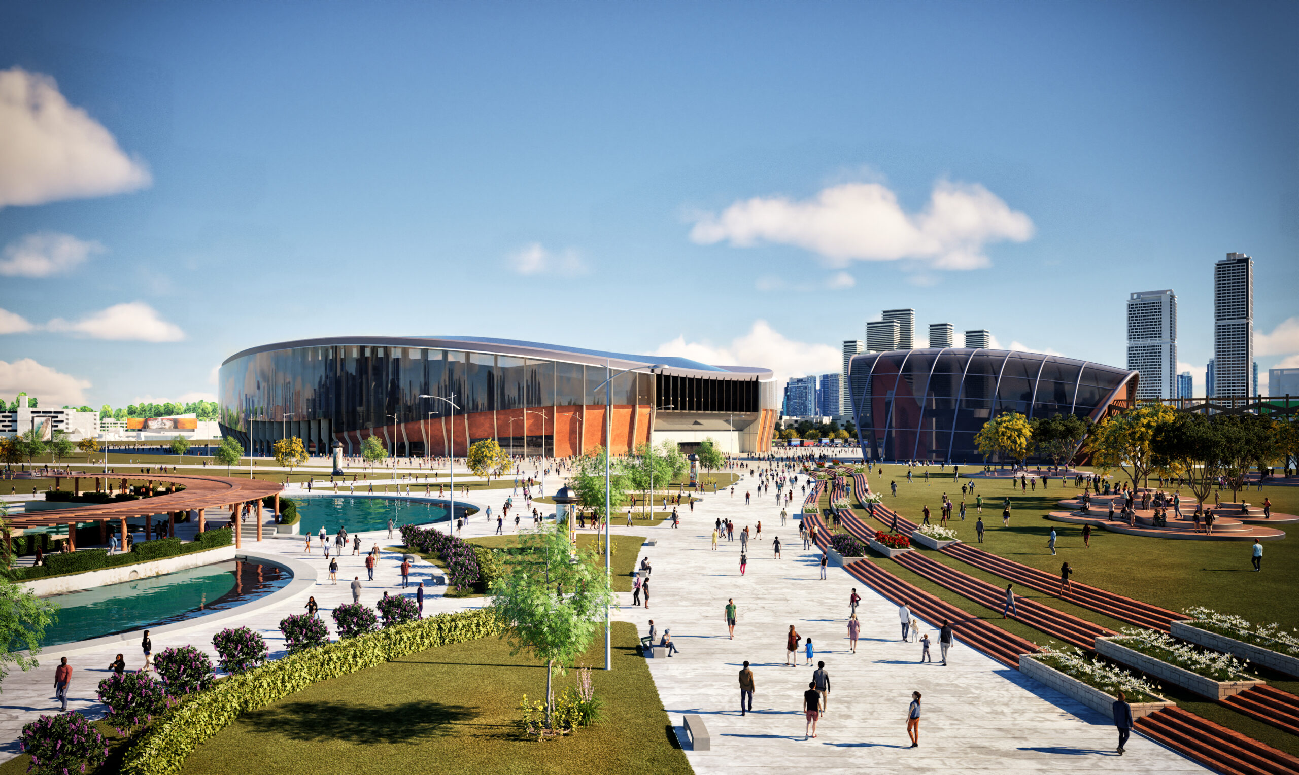
(RWDI Company – 2024)
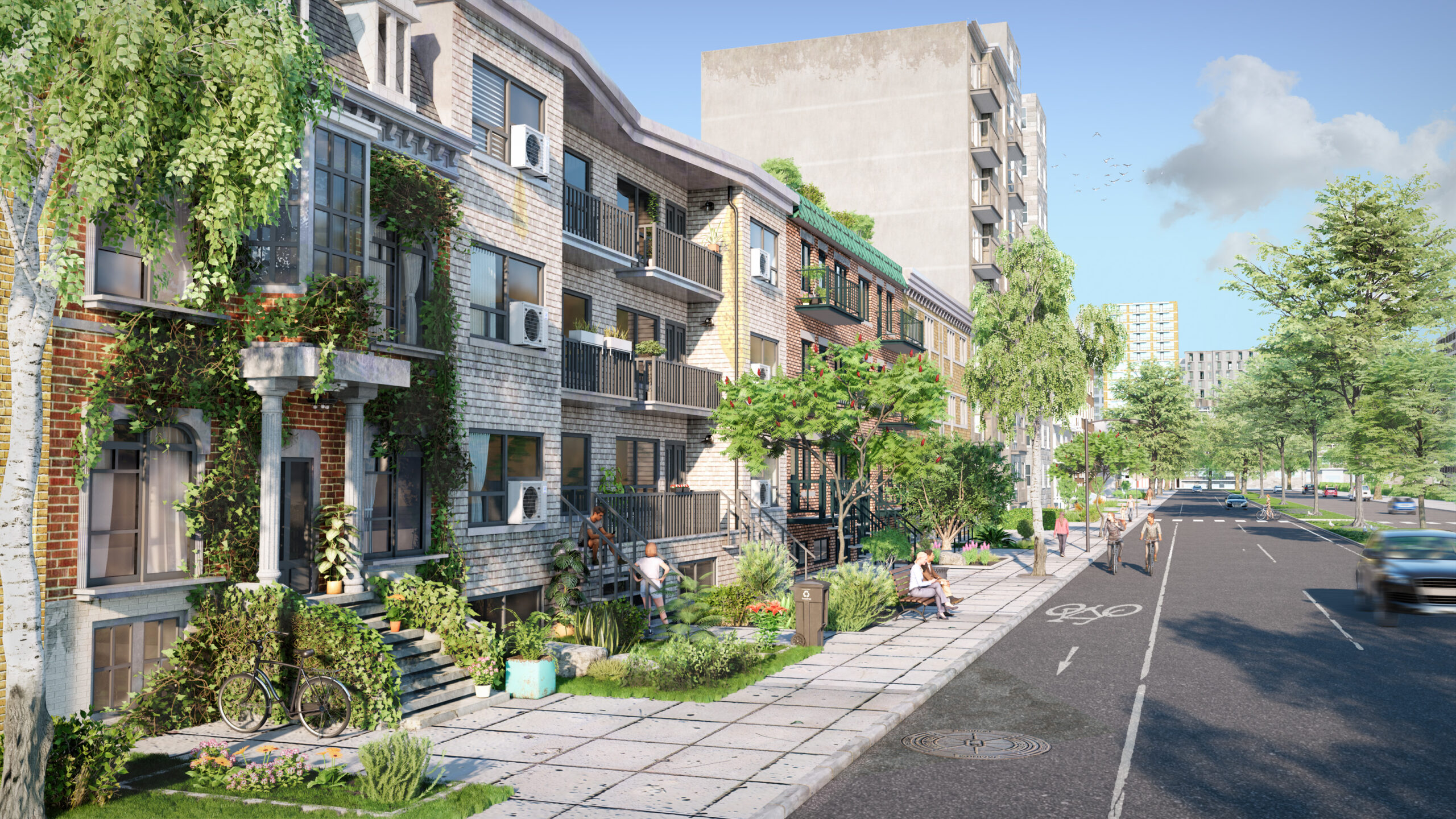
Produced early-stage massing and environmental analysis for a stadium proposal, including PLW ( pedestrian level wind) & shadow studies and visualization materials.
Keywords: CFD Simulation • PLW • Massing • Stadium • Urban Study • 3D Modeling
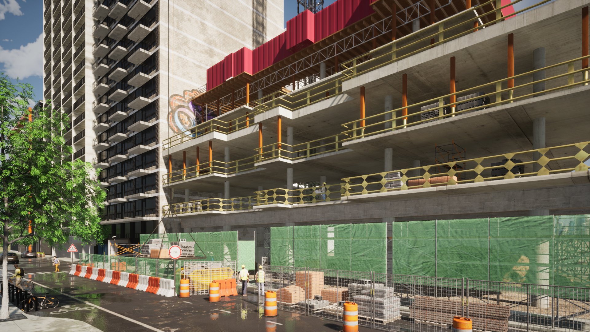
Urban Environmental Simulation Project
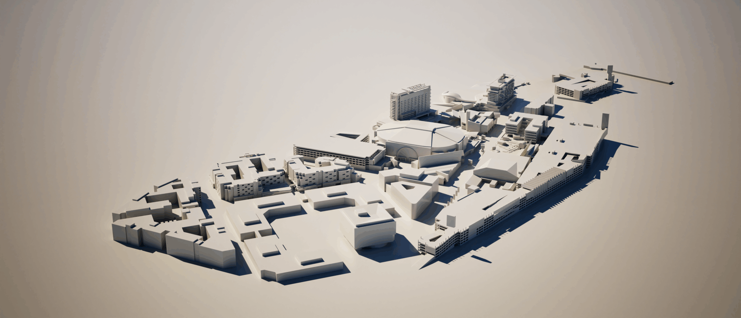
Case Study: OCVIBE
(RWDI Company – 2023)
Developed a watertight, simulation-ready 3D master plan model for a Pedestrian-Level Wind (PLW) study, focusing on clean topology and time-efficient geometry reconstruction. The model included full site massing—towers, podiums, landscape, and context—optimized for reliable import into PLW and CFD analysis tools.
Keywords:PLW • Urban Microclimate • CFD-Ready Models • Massing Optimization • Environmental Simulation
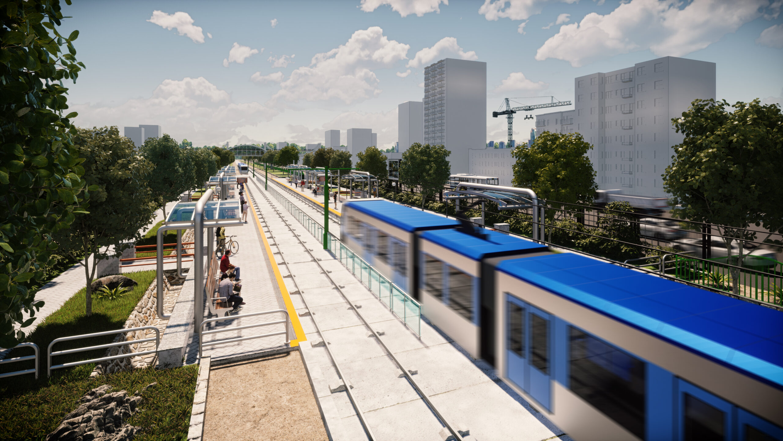
(Urban Infrastructure • 2013)
Supported the modeling and visualization of a large-scale LRT corridor, including station massing, terrain alignment, and conceptual presentation materials.
Keywords: Transit Design • Infrastructure • 3D Modeling
Academic & Research Projects
(Programming & Modeling)
Case Study: MacKay St, Montreal, Quebec
(Concordia University — 2019
Published in Journal of Transportation Engineering, 2020)
A research-driven urban simulation analyzing how sun glare and contrasting shadows affect driver visibility.
The study combines Python Programming, GIS-based 3D modeling, solar simulations, and shadow analysis to evaluate impairment risk in dense urban corridors.
Keywords: Python • Shadow Study • GIS • Data Visualization • Research • 3D Modeling
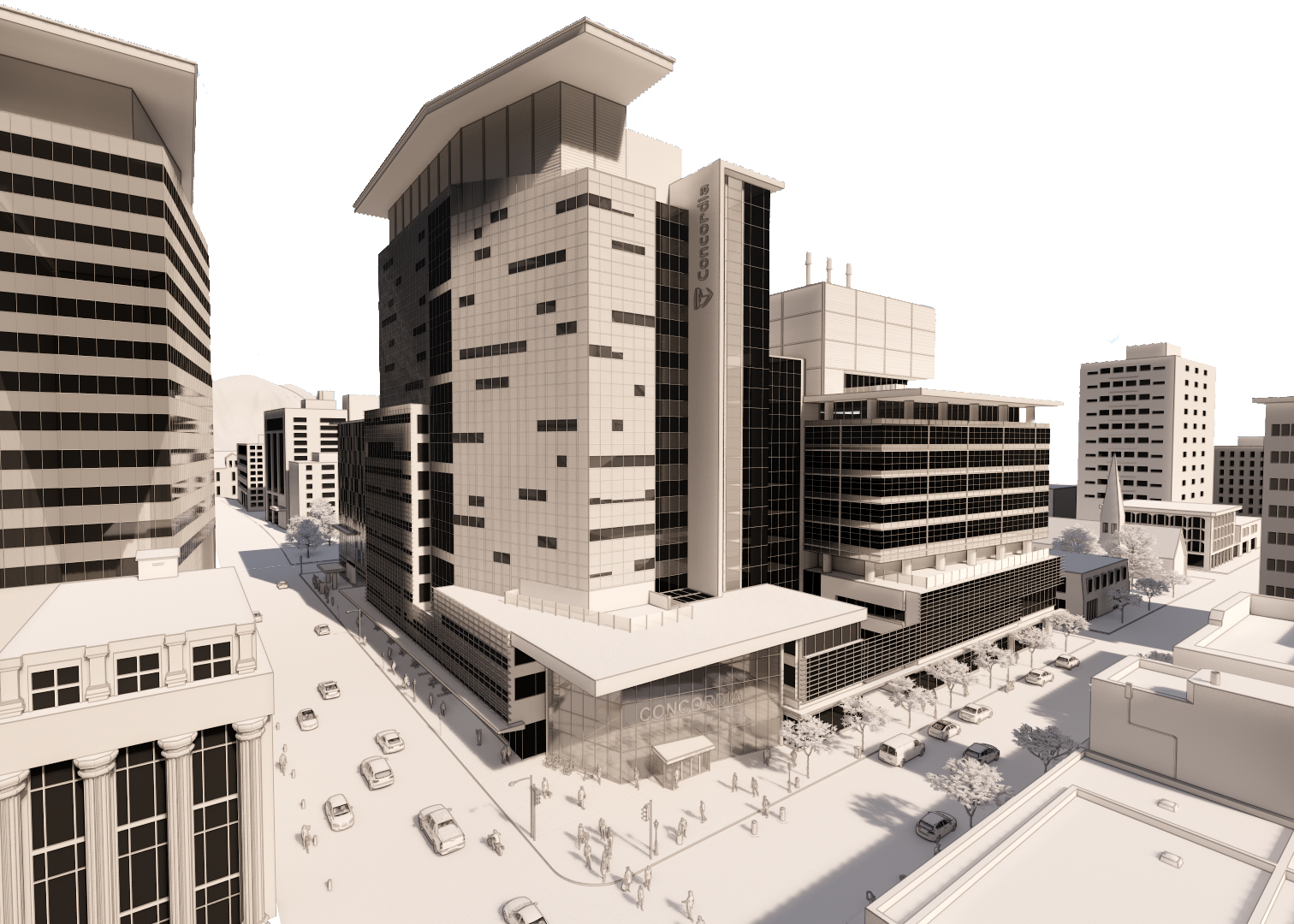
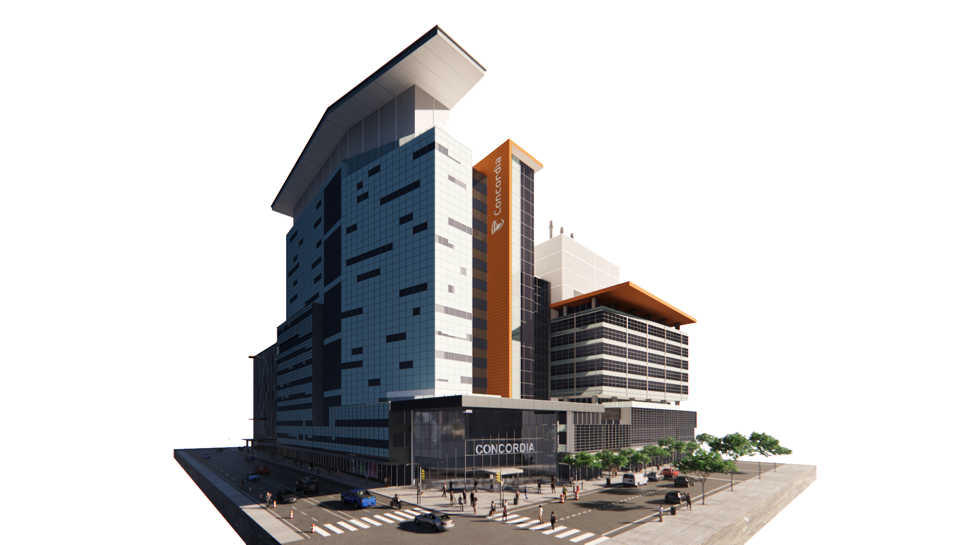
Case Study: Concordia University, EV Building, Montreal, Quebec
(Concordia University — 2019)
Developed a high-resolution 3D digital model of Concordia’s SGW Campus that merges GIS datasets, multiscale traffic behavior, and dynamic environmental conditions. The project employed immersive visualization methods and VR-ready rendering pipelines to support advanced research applications, scenario evaluation, and interactive urban analysis.
Keywords: Digital Twin • Urban Modeling • VR • 3D Modeling
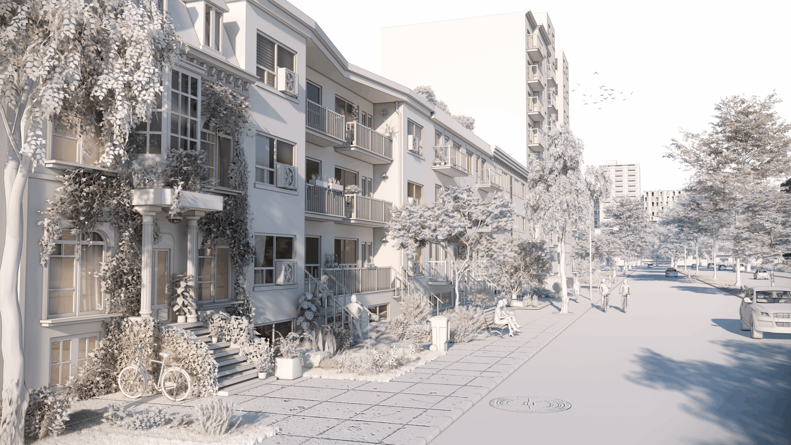
Case Study: Montreal Neighborhood, Quebec
(Concordia University — 2020)
Implemented a VR-based system for interactive shadow exploration that enables users to examine solar behavior, assess seasonal effects, and optimize spatial configurations. Real-time simulation workflows support research, design testing, and experiential evaluation of urban lighting conditions.
Keywords: VR • Shadow Visualization • Real-time Simulation • 3D Modeling
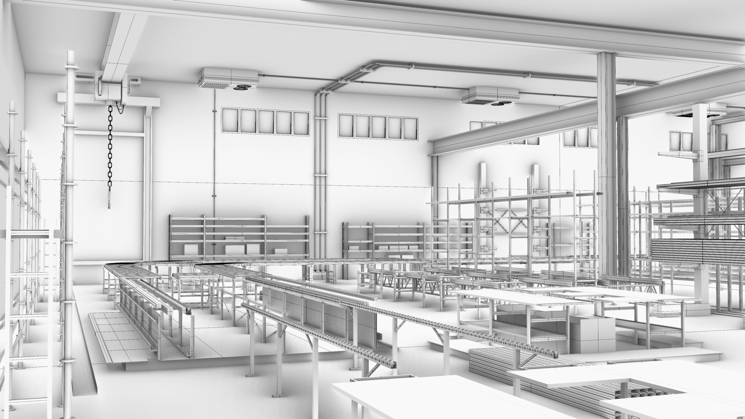
Case Study: Fortis LGS Company
(Edmonton, Alberta – 2018)
Developed both high-detail and performance-optimized low-poly 3D models of a full manufacturing plant for use in layout planning, automation studies, and real-time virtual simulations. The optimized assets were tailored for VR environments, robotic path simulations, and production workflow analysis, enabling rapid iteration with minimal system load.
Keywords: Industrial Modeling • Optimization • VR • Simulation
Other Projects

Automation & Tools
(Python & Grasshopper)
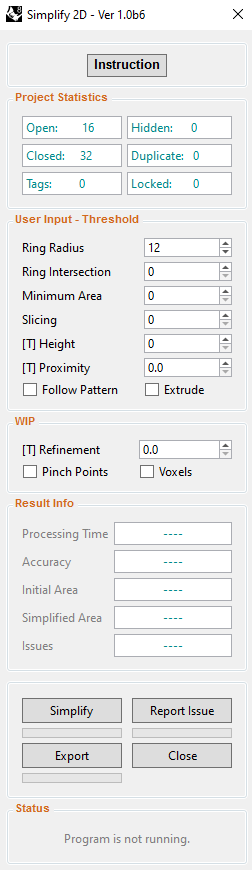
Simplify 2D – [2D Footprint Simplification Tool]
(RWDI Company – 2023 – 2024)
Built an automated tool that analyzes and simplifies 2D building footprints using rules such as distance, height, area, and proximity threshold. The script removes unnecessary small edges and produces clean, low-detail context geometry optimized for CFD and CNC workflows.
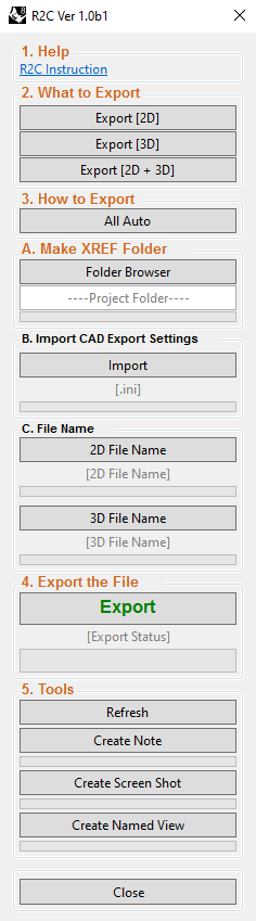
R2C [Rhino Exporter Automation Tool]
(RWDI Company – 2023)
Developed a fully automated export pipeline that collects all 2D and 3D geometries in a Rhino project, processes them according to internal company standards, and saves each output into the correct directory structure. The tool ensures consistent naming conventions, clean layer organization, and error-free file packaging, eliminating manual export work and significantly improving workflow efficiency across design and production teams.
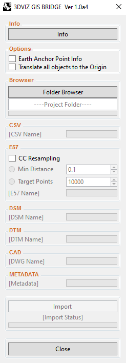
3DVIZ GIS Bridge [Rhino–GIS Automation Tool]
(RWDI Company – 2023)
Developed a full automation pipeline to import and transform GIS datasets (footprints, point clouds, geolocation attributes), streamlined data preparation within Rhino for subsequent modeling, analysis, and visualization, and facilitated the export of final 3D models back into the central GIS database.
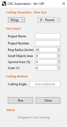
CNC Automation Tool
(RWDI Company – 2024)
Streamlined CNC preparation by automatically extracting, simplifying, and categorizing footprints from 3D models — producing ready-to-cut profiles optimized for multiple machining methods.
Keywords: Automation • Python • Geometry Optimization • CFD Prep • CNC Workflow • RhinoScript • GIS Integration • Export Pipeline • Workflow Standardization • Productivity Tools
Parametric Massing & Shadow Study Tool
(Python & Grasshopper)
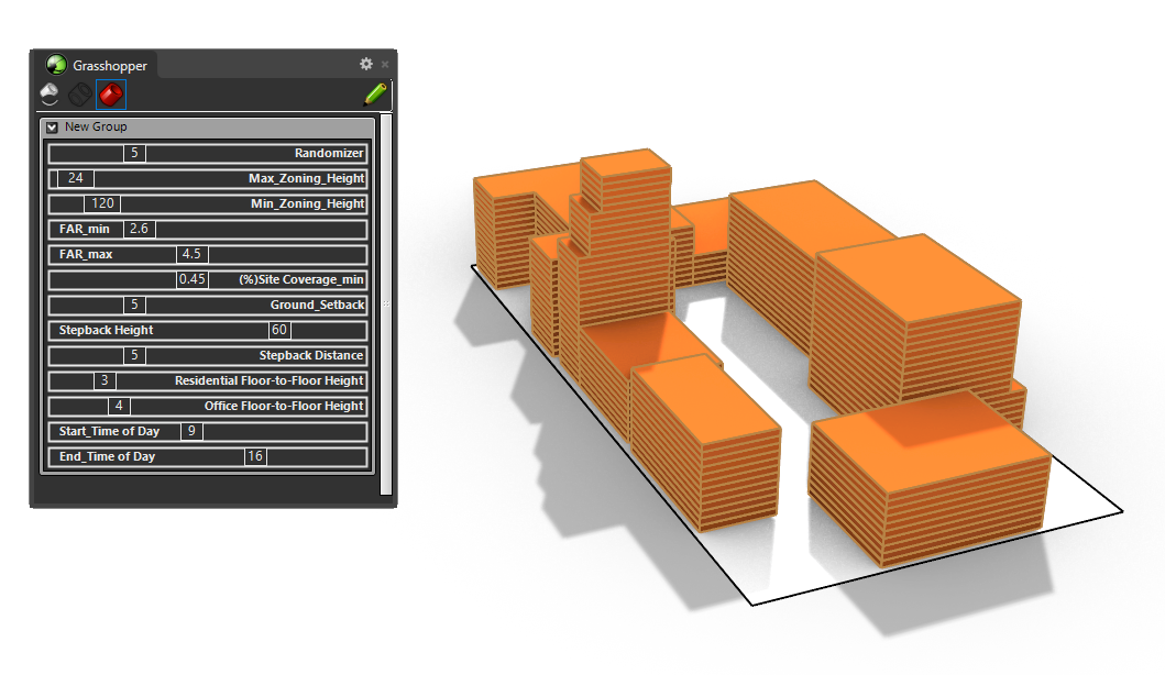
This Grasshopper workflow generates and evaluates building massing configurations within zoning constraints using a coordinated set of sliders. The definition includes controls for maximum and minimum zoning heights, FAR range, minimum site coverage, ground setback, stepback height, stepback distance, and separate residential and office floor-to-floor heights. These parameters drive the parametric massing blocks shown on the site boundary, allowing the geometry to be reshaped quickly while staying within all defined limits.
A dedicated Randomizer slider determines how many alternative height configurations are tested. For each run, the tool produces different massing variations within the allowed ranges and computes the corresponding shadows over a selected time window, defined by start- and end-time sliders. After cycling through the number of scenarios specified by the Randomizer, the setup compares the resulting shadow footprints and identifies the configuration with the minimum shadow-casting area as the best scenario. This provides a clear, repeatable method for studying how zoning parameters and height distribution influence shading on the ground and adjacent structures.
WIP: Additional refinement is ongoing to improve the evaluation workflow, streamline scenario comparison, and expand the clarity of visual outputs within the Grasshopper canvas.